Eco-Vis Map Portal
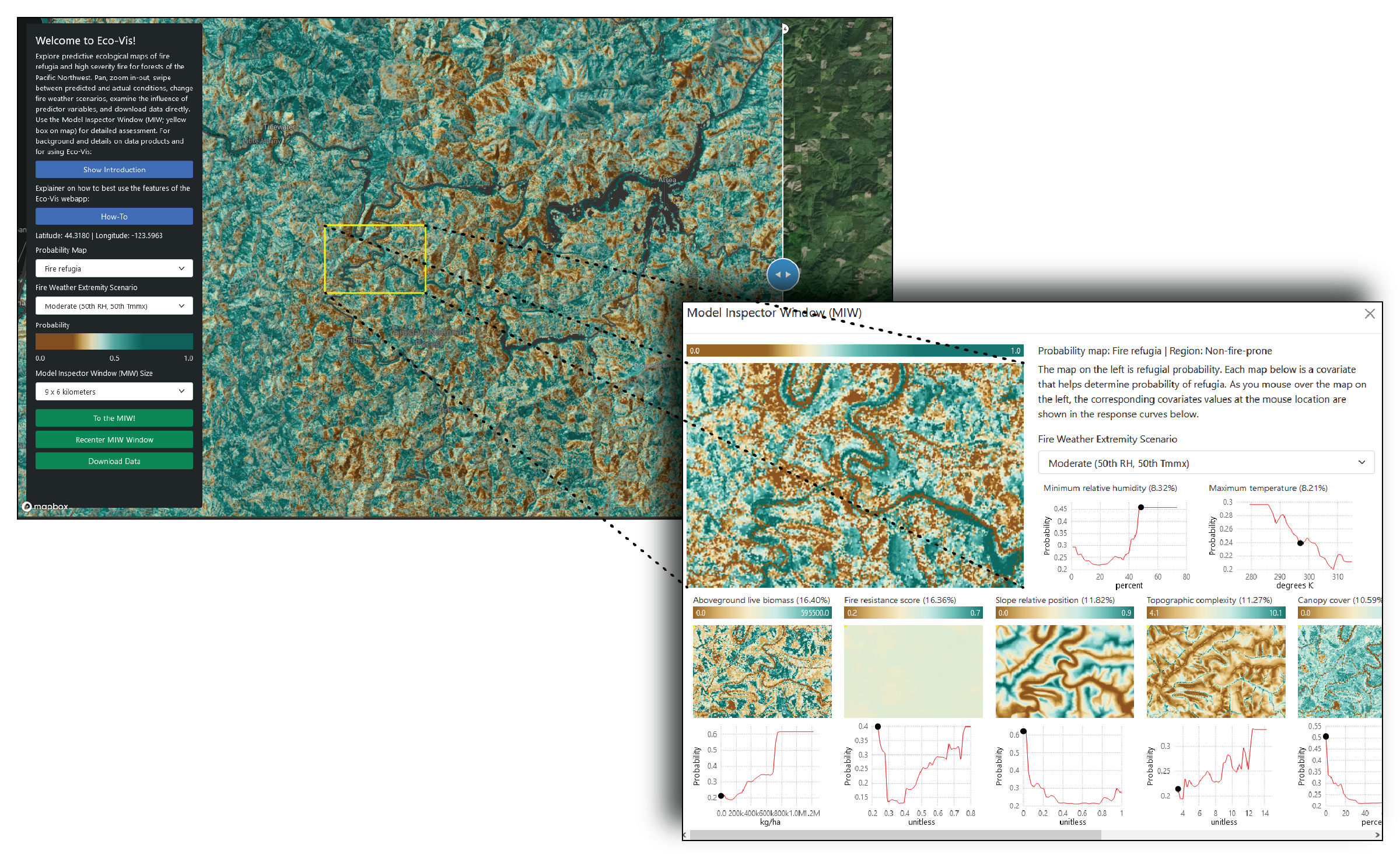
Eco-Vis is a web-based map portal that provides access to the suite of products generated by the fire refugia project and a visualization tool that links model inputs, outputs, and statistical relationships. Eco-Vis is a unique platform for exploring ecological probability maps through user-guided graphical and geographic examination of the complex interactions that drive model predictions under differing climate and vegetation scenarios or for specific areas of interest. Basic background and instructional content is contained within Eco-Vis (see “Show Introduction” and “How-To” on main panel). For more detailed background on fire refugia products, methods, publications, and alternative data access platforms, see the Findings page.
A full set of data products are described and can be accessed through Outreach Materials.
Click HERE to launch Eco-Vis and get started! Note, Eco-Vis currently runs on our v3 products, we’ll be updating to v4 shortly.